Aerial Solutions Designed for Real-World Performance
Highsight Drone Solutions provides professional drone services that help organisations work smarter, operate more safely, and make better-informed decisions. By combining advanced drone technology with high-quality aerial data, we deliver efficient, cost-effective solutions that reduce manual labour, minimise operational risks, and improve productivity across a wide range of industries.
Whether inspecting critical infrastructure, securing large facilities, mapping construction sites, or supporting precision agriculture, our services are designed to provide accurate results with minimal disruption.
Aerial Inspections
Traditional inspections can be time-consuming, costly, and hazardous. Our drone inspection services provide a safer and more efficient alternative by capturing high-resolution aerial imagery of buildings, bridges, power lines, pipelines, telecommunications infrastructure, industrial facilities, and other critical assets.
Detailed aerial inspections allow businesses to identify defects early, schedule maintenance proactively, and reduce downtime while keeping personnel out of dangerous environments.
Mapping & Surveying
We produce highly accurate aerial maps, orthomosaics, topographic surveys, and 3D terrain models that support planning, engineering, construction, mining, agriculture, and infrastructure development.
Using advanced drone technology, we collect precise geospatial data in a fraction of the time required by traditional surveying methods, helping clients make informed decisions with confidence.
High-Rise Building & Solar Panel Cleaning
Maintain commercial buildings and solar installations safely and efficiently using drone-based cleaning technology. Our solutions eliminate the need for scaffolding, rope access, and elevated work platforms, significantly reducing safety risks and operational costs.
For solar farms and commercial rooftop installations, regular drone cleaning removes dust, dirt, and debris that reduce panel efficiency, helping maximise energy production, improve performance, and extend the lifespan of valuable assets.
Cellphone Tower Inspections & Maintenance
Our drone technology enables fast and accurate inspections of telecommunications towers, antennas, and supporting infrastructure, including sites located in remote or difficult-to-access areas.
We assist telecommunications providers with structural inspections, fault detection, equipment monitoring, and panel cleaning, reducing maintenance time while improving worker safety and minimising service interruptions.
Energy & Utilities
Reliable energy infrastructure requires regular inspection and monitoring. We provide drone services for solar farms, substations, wind installations, power lines, Battery Energy Storage Systems (BESS), and other utility assets.
High-resolution aerial inspections help identify faults before they become costly failures, allowing organisations to improve maintenance planning, increase operational reliability, and reduce downtime.
Mining & Industrial Solutions
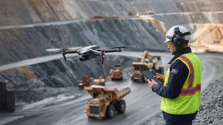
Mining and industrial operations demand continuous monitoring and accurate site intelligence. Our drone services include infrastructure inspections, stockpile volume calculations, environmental monitoring, progress reporting, compliance support, and aerial security surveillance.
By replacing manual inspections with aerial data collection, organisations can improve safety, reduce operational costs, and gain valuable insights that support more efficient site management.
Precision Agriculture & Environmental Monitoring
Modern agriculture depends on accurate, timely information. Our drone solutions provide crop health analysis, irrigation assessments, vegetation monitoring, pest detection, environmental surveys, and land assessments that help farmers optimise productivity while reducing unnecessary resource use.
We also support environmental management projects through habitat monitoring, vegetation mapping, and conservation initiatives that contribute to sustainable land management.
Security & Surveillance – Eyes in the Sky
Protect people, property, and critical assets with intelligent aerial surveillance solutions. Our drones provide real-time monitoring for residential estates, commercial properties, industrial facilities, mining operations, and public infrastructure.
Equipped with thermal imaging, infrared sensors, and AI-enabled technologies such as facial recognition and vehicle identification, our systems support perimeter patrols, breach detection, incident response, and enhanced situational awareness during both day and night operations.
Critical Infrastructure & Public Safety
We help organisations monitor and protect essential infrastructure including rail networks, roads, bridges, substations, pipelines, power lines, and public facilities.
Drone inspections improve safety by reducing the need for personnel to access hazardous environments while delivering accurate data that supports maintenance planning, infrastructure management, and public safety initiatives.
Digital Twins & 3D Modelling
Create detailed digital representations of physical environments using advanced aerial mapping and photogrammetry. Our digital twin and 3D modelling services support engineering, construction, mining, infrastructure management, and urban planning projects.
These highly accurate digital assets improve planning, simplify asset management, and enable organisations to visualise and analyse sites with greater precision
Disaster Response & Emergency Support
During emergencies, timely information is critical. Our drone solutions provide rapid aerial intelligence for disaster response, search and rescue operations, fire monitoring, flood assessments, and emergency planning.
Real-time aerial imagery enables emergency teams to assess affected areas quickly, allocate resources effectively, improve response times, and reduce risks to personnel operating in hazardous environments.
Benefits
Smarter Technology. Better Results.
We provide advanced drone technology and aerial intelligence services that help businesses collect accurate data, inspect critical assets, and improve operational efficiency across multiple industries.
Fast & Efficient
Complete inspections and surveys in a fraction of the time compared to traditional methods.
Improved Safety
Inspect difficult or hazardous locations without putting personnel at risk.
Accurate Data
Capture high-resolution imagery and precise measurements for reliable analysis and reporting.
Cost Effective
Reduce downtime, labour costs, and expensive equipment requirements through efficient aerial operations.
Actionable Insights
Transform aerial data into meaningful information that supports planning, maintenance, and operational decisions.
Industry Expertise
Trusted solutions for telecommunications, energy, mining, agriculture, infrastructure, conservation, and public safety.